Washington's
Olympic Coast

Flying west along the Strait of Juan de Fuca past Port Angeles, you come to the town of Clallum Bay.

The State of Washington and the town fathers thought this fishing and logging village would make a great place to send bad boys from the big cities - hence this lonely outpost in the middle of nowhere - a State Prison known officially as the Clallum Bay Corrections Center.

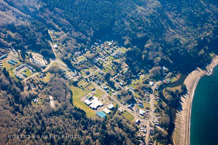
Next along the coast is the tiny fishing village of Sekiu - it has the last airstrip until you go down the coast to Forks.
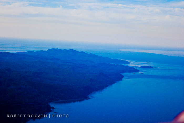
Looking west towards the NW corner of America

The last town is Neah Bay - a sport fishing destination


Flying towards the tip


The end of America is a rugged headland called Cape Flattery
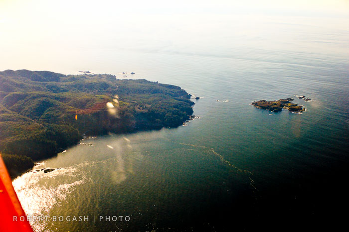
Just off Cape Flattery is the very last land - a small cluster of rocks and islands known as Tatoosh Island

Sunlight reflecting off the water at just the right angle created this ghostly silhouette with wonderful patterns on the sea's surface

 Tatoosh


Tatoosh is home to a lighthouse - the first beacon of light seen by ships approaching the Strait of Juan de Fuca.
An aviation navigation aid nearby on the mainland is the first radio beacon picked up by trans-Pacific flights.

Looking back east along the rugged and isolated Washington coastline marking the south shore of the Strait of Juan de Fuca

Turning the corner and turning south to parallel Washington's rugged Pacific coastline

Rocks, forest, driftwood, wildlife and ever changing beaches extend along the entire coast.
 Sea stacks provide dramatic evidence of the receding coastline

A dramatic vista of crashing waves that have been the graveyard for many ships over hundreds of years.

The
Waatch River flows westward past the small settlement towards Makah Bay
on the Pacific side. All of this lies on the Makah Indian
Reservation. At the top in the background is the Strait of Juan
de Fuca.

Ahead lies Cape Alava and Lake Ozette


The Quillayute River flowing westward into the Pacific between Forks and La Push on the Quileute Indian Reservation


Alexander Island
 The mouth of the Hoh River

 Abbey Island
 Destruction Island, shaped like a fish, is one of the stormiest places on Earth

The late afternoon sun makes the "fish" come alive while the ocean currents trace intriguing patterns


This short stretch of U.S. Hwy 101 is the only place that runs along the coastlineThis

Nestled by Kalaloch Creek is the Park Service's small Kalaloch Resort - great views, but pricey for a small cabin


The most impressive mouth of the Queets River


Tunnel Island at the mouth of the Raft River on the Quinault Indian Reservation


 Little Hogsback


Point Grenville
